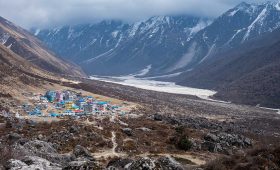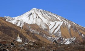


Langtang Trek Map is a professional guide map designed to help trekkers navigate the Langtang region of Nepal with accuracy and confidence. It graphically outlines the main trails, villages, peak mountains, altitudes and natural elements that make up the Langtang trek.
The Langtang area is large, remote and has interconnecting routes. So, it is necessary to have a specific map for routing planning, distance estimation, terrain comprehension and safe travel. Particularly in regions where GPS reception can be weak or non-existent, a physical or detailed digital map turns into an irreplaceable friend.
This map shows significant trekking routes like the Langtang Valley trek, the Tamang Heritage Trail and linking trails to Gosaikunda and Helambu regions. It shows major overnight settlements like Syabrubesi, Lama Hotel, Langtang Village and Kyanjin Gompa and side trails to vantage points like Kyanjin Ri and Tsergo Ri. The map also includes altitude levels, so that trekkers can track their gain in altitude and arrange for proper acclimatization.

Further, it indicates the location of high Himalayan peaks, monasteries, lakes and resting points. These markings render trekkers capable of organizing the trip confidently, minimizing side-tracks and controlling their trekking timing in a perfect way based on their fitness and time.
Reading the Langtang trek map contributes to the overall trip experience by maximizing planning, safety and knowledge about the upcoming journey. It is all about identifying color-coded routes, reading elevation markings and direction arrows to trace your day-by-day routes. For first time trekkers, it provides assurance while for frequent adventurers, it provides flexibility in route and exploring new paths outside established tracks.
By providing you with a vivid picture of where you are and where you are heading, the Langtang Trek map transforms what might seem like a confusing mountain maze into a well researched and compelling Himalayan journey.
Reading and Understanding the Langtang Trek Map
Base Camp Adventure’s map illustrates the Langtang Gosainkunda Helambu trek map. It is a well liked and diverse trail in northern Nepal within the Langtang National Park. The trek starts at Kathmandu and crosses the high Himalayas, sacred lakes and culturally important villages of the Langtang region.
The journey begins from Kathmandu, the capital of Nepal. You then typically drive by jeep or bus to Syabrubesi, where the trek begins. It is where you usually make arrangements for equipment and permits before departing.
The trek up to Syabrubesi proceeds north of the Langtang River through rhododendron forests, waterfalls and alpine pastures.

Key stops along the route:
- Syabrubesi (1,600 m) – Start of the trek.
- Lama Hotel (2,470 m) – First overnight stay deep in the woods.
- Langtang Village (3,430 m) – Rebuilt after 2015 earthquake.
- Kyanjin Gompa (3,870 m) – Spiritual and scenic hub with a monastery.
- Kyanjin Ri (4,400 m) or Tsergo Ri (4,984 m) – Optional day hikes for panoramic views.
To the west of the main trekking route is the Tamang Heritage Trail, which gives a close-up experience of local culture and the traditional way of living in Tamang villages.
Key villages and locations:
- Gatlang Village
- Briddhim
- Tatopani – Renowned for natural hot springs.
- Nagthali – Scenic view.
- Rasuwagadhi – Close to the Nepal-China border.
This trail is less traveled and ideal for people who are interested in ethnic culture, homestays and Nepalese hospitality.
Further reading the Langtang Valley trek map, from Thulo Syabru, you ascend to the Gosaikunda lakes, a region of holy alpine splendor.
Main stops are:
- Sing Gompa (Chandanbari) – Monastery and cheese factory.
- Lauribina
- Gosaikunda (about 4,380 m) – Holy lakes, sacred to Hindus and Buddhists.
Gosaikunda is particularly significant during the Janai Purnima festival, when pilgrims in thousands trek there. The lakes lie between ridges of considerable altitude and are surrounded by peaks and glaciers.
Major Peaks Along the Route
The map of Langtang trek identifies several prominent Himalayan peaks in the area. These offer impressive backdrops to your hikes.

Main peaks and elevations:
- Langtang Lirung – 7,227 m
- Langtang II – 6,596 m
- Naya Kanga (Ganja La Chuli) – 5,863 m
- Baden Powell Peak – 5,826 m
- Surya Peak – 5,145 m
- Tsergo Ri – 4,984 m
- Kyanjin Ri – 4,400 m
- Chhyarkung Chuli – 4,552 m
- Lari Peak – 4,868 m
These peaks can be seen from several viewpoints during the trek and a few might be climbed by experienced trekkers with proper preparation. They form the backdrop for the majority of the trek, offering dramatic scenery of the area.
Helambu Region and Exit Route
The trek from Gosaikunda extends over Lauribina La pass and south to the rich, Buddhist-influenced Helambu region, which offers scenic vistas.
Notable stopping points on the downhill journey:
- Gopte
- Tharepati
- Gul Bhanjyang
- Chisopani
- Sundarijal – The end point of the trek, with road access to Kathmandu.
This final part is in stunning contrast to the alpine landscape, with stepped farms, dense woods and ancient hill villages.
Alternations in the Trekking Route
Langtang Gosaikunda Helambu Trek map is highly flexible and can be adjusted according to your time, fitness and interest.
Routes that can be used:
- Langtang Valley only: 7–9 days
- Langtang and Gosaikunda trek: 12–14 days
- Full Circuit (Langtang–Gosaikunda–Helambu): 16–20 days
- Include Tamang Heritage Trail: +4 to 5 days
You can retrace or make a loop through Helambu for a complete circuit.
Why Is the Langtang Map Essential for Trekkers?
The Langtang Trek Map is vital for anyone who will hike out into this stunning Himalayan terrain. Exploring the high Himalayas without a reliable Langtang trek route map can be confusing and risky. This is especially true for those unfamiliar with the trails and rapidly changing mountain weather. The map gives you a complete sense of the route, keeping you on track and from losing your way in areas where cellular signals may be weak or non-existent.
Besides simple orientation, the map has essential information on elevation change, villages, resting places, passes and viewpoints. This enables you to organize your day-to-day distance in advance, pace yourself for effective acclimatization and choose appropriate places to rest or get help in the event of an emergency. The map also shows permit posts and health stations that are crucial for compliance as well as safety in the area.
This way, the Langtang Trek map makes the hard to navigate Himalayan landscape easy to manage and pleasant. It enables you to traverse with confidence, make informed decisions and fully immerse yourselves in the natural and cultural beauty of Langtang.
Key Features of the Langtang Trek Map
- Primary trekking trails from Syabrubesi to Langtang Valley to Kyanjin Gompa and day hikes to Tserko Ri or Kyanjin Ri are emphasized on the map.
- All passes, major way points and villages are named with elevation so that trekkers can acclimatize comfortably and estimate hiking distances on a daily basis.
- Primary peaks, monasteries, lakes and viewpoints are indicated allowing trekkers to identify must-see sites and viewpoints along the route.
- Trekking checkposts and permit offices in the region are indicated on the map.
- Teahouse, lodge, health post, and water sources are indicated, making plans for night stops and rests convenient.
- Syabrubesi to Kathmandu roads that offer transportation to trailheads are indicated on the map to facilitate planning logistics.
- A beginner friendly legend explains symbols for trails, camps, bridges and emergency points such that even novice trekkers can make use of the map.
- Certain editions include a side graph or profile showing daily altitude gain and loss giving a visual impression of the physicality of the trek.
How Map Enhances Your Trekking Experience?
The best Langtang Trek map transforms your entire trekking experience. By thoroughly mapping trails, rest stops and landmarks, the map allows you to venture into the Himalayan wilderness with confidence and ease. It reduces the chance of getting lost or encountering unexpected challenges along the way.
With accurate altitude information and elevation profiles, the Langtang map enables you to pace yourself sensibly allowing you to acclimatize properly and avoid altitude sickness. Knowing where the mountain’s steep climbs begin or where you may need to rest makes your walk safer and more enjoyable.
Further, the map enables you to plan your days effectively, where to sleep, when to progress and how to alter your route as needed. It also marks major resources like lodges, health posts and permit checkpoints, so you are properly prepared for each stage.
The Langtang Trek map is your best buddy, guiding you through confusing trails, helping you make the correct decisions and making your trek a more enjoyable and satisfying experience.
Physical Map Vs Digital Map – Which to Carry for the Langtang Trek?
As you prepare for your Langtang Trek, one of the most significant questions you may have is whether to use a physical map or a digital map. Each has its own benefits and understanding the difference can help you make an informed decision. It is better to carry both the maps for a risk free journey.
Physical maps give you a broad, uninterrupted view of the entire route and trails, elevation gain, villages, rivers, forests and side treks are visible at a glance. They are also light, foldable and don’t require a signal or charging. In low visibility or when there is no network, a paper map is more dependable than electronic devices.
Digital maps, especially on trekking apps like Maps.me, Gaia GPS or AllTrails, provide features that a paper map does not. They also have GPS tracking, live location and searchable place names. This proves especially handy if you get lost from the trail or you want to keep an eye on your distance and speed.
Most digital maps also provide user-contributed updates on trail conditions, new routes or teahouse availability. But they do have their limitations like requiring a powered phone, pre-installed offline maps and even additional power sources like battery packs. Relying solely on them can be risky in case your phone switches off or stops working in the cold.
Ultimately, the best solution is to use both. Consider the physical map for orientation, route planning and general daily use and the digital map for real time navigation and in emergencies. Both together give an equitable way of traveling to Langtang Valley confidently. No matter how convenient technology becomes a paper map keeps you from being totally reliant on devices. In the mountains, this balance can be the difference between success and failure.
Symbols, Icons and Legend on the Langtang Trek Map
A trekking map is only effective if you know how to read it and that’s where the legend plays a key role. The Langtang Trek map boasts a good legend that explains the various symbols and icons that are utilized to represent key features of the trail. These graphical indicators provide you with at-a-glance information that is easily interpreted even for novice trekkers. The following is what you will typically find in the legend:
Trail Markings
Solid Lines: Main trekking trails (e.g., Syabrubesi to Kyanjin Gompa).
Dashed Lines: Side trails, detours or optional routes.
Arrows: Direction of trail (especially in circuits or loop trails).
Accommodation and Rest Stops
Tent icon: Campsites (although the Langtang is a teahouse trek, campsites may be marked).
Lodge icon: Teahouses or village guesthouses.
Village name with elevation: Help trekkers judge overnight accommodations and altimeter gain.
Health and Safety Symbols
Red cross or medical symbol: Medical first aid points and health clinics.
Permit checkpoint symbol: Points where trekking permits have to be shown.
Police post symbol: Police stops along the trail.
Infrastructure Symbols
Bridge symbol: Wooden or suspension bridges over streams and rivers.
Road symbol or bus symbol: Portable roads or transport stations (e.g., the Syabrubesi road).
Natural Landmarks
Mountain top symbol: Aerial view of surrounding mountains or visible summits (such as Langtang Lirung, Tsergo Ri).
Lake or droplet of water symbol: Lakes or water bodies (possibly located near Gosaikunda extensions).
Tree or forest sign: Dense forests, especially in the area of Lama Hotel and Bamboo.
Cultural and Scenic Points
Monastery or stupa symbol: Cultural places like the Kyanjin Monastery in Kyanjin Gompa.
Viewpoint symbol (eye or binoculars): Scenic places or panoramic views.
Cave or glacier symbol: E.g., the Langtang Glacier or Langshisha Kharka.
Map Legend Design Elements
Coloring: Trails, elevation ranges and land types may be colored to distinguish.
Scale bar: To find the measurement of the distance between two points on the map.
Contour lines: Indicate change in land steepness and elevation.
North arrow: Classic map reading direction pointer
How the Langtang Map Assists Safe and Responsible Trekking
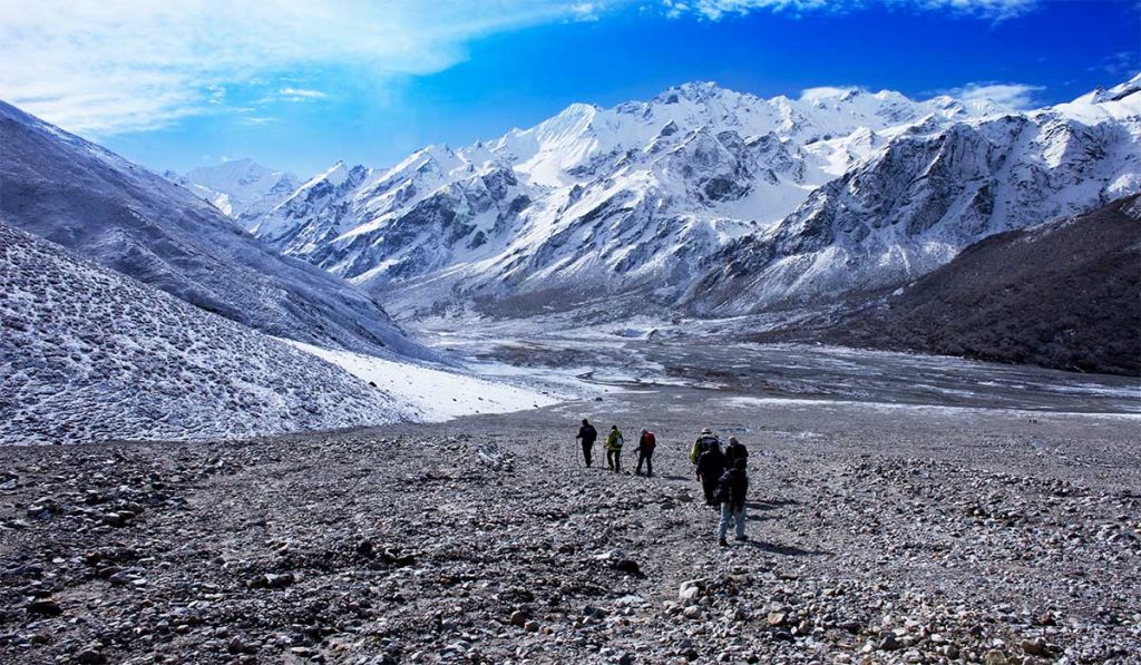
The Langtang Trek Map is a valuable aid in providing safety for trekkers following the isolated Himalayan trails. It marks important milestones such as health posts, permit offices and emergency evacuation trails, which are essential during a mishap, sickness or altitude problem. By keeping you on well marked trails, the map also diminishes the risk of getting lost especially where trail signs fade in dense forests or alpine heights.
Apart from security, the map promotes responsible trekking by guiding you through officially approved courses and avoiding environmentally sensitive or prohibited areas. It helps to limit human impact by pointing out designated camping spots and dumping sites. It also supports local infrastructure while helping to avoid disruption of pristine wilderness. In the Langtang region tourism and conservation have a delicate balance. Mapped trails help in the conservation of the environment as well as the preservation of local cultural zones.
In addition, the map offers you more self reliance and competence which alleviates pressure on local infrastructure and emergency services. For instance, by examining elevation profiles and gradual ascent, you are better able to bypass altitude sickness and overexertion. It also helps estimate the time between villages so visitors don’t get stuck on the trail after dusk. In all, the Langtang Trek Map serves not only to guide but also to encourage a kind of trekking that is informed, educated and environmentally friendly.
Tips for Using the Langtang Valley Trek Map Effectively
- Understand the trail, key elevation points and significant stops before embarking on your trek.
- Mark significant places like Syabrubesi, Lama Hotel, Langtang Village, Kyanjin Gompa and Tsergo Ri.
- Split the trek into manageable segments and record your day’s trek in terms of distance and elevation.
- Schedule rests, sidetrips and acclimatization stops based on the map.
- Use the altitude markers and elevation profile to monitor your rise and prevent altitude sickness.
- Langtang has some trail intersections and side trails. Check where the path branches out as marked on the map.
- Stick to the main trail unless you are experienced and well-equipped for side excursions.
- Use the map to find lodges, health posts, permit offices and sources of water ahead of time.
- It’s convenient to use digital maps but they are battery and internet dependent. Use your paper map as a primary reference and apps as secondaries.
- Look at your map to identify possible shelters or alternative routes if anything unexpected arises.
- Memorize the symbols, color codes and icons on the map so you can glance at it swiftly on the trail.
Also Read: